
Madrid · Spain and Europe

Aerial inspection and data to build, maintain and grow

Thermal imaging, surveying and documentation by drone. We capture the data, process it and deliver it ready to use.

What we do

From the flight to data you can use

Altamira Drones is a Madrid-based technical drone services company. We capture the data, process it and deliver it as something you can act on: a report that pinpoints the problem, a model you can measure from the office, a drawing you can take to site.

We work for contractors, developers, architects, engineering firms, public bodies and farms. Each service is described below with what it includes, what we deliver and when it makes sense.

How we work

  • We handle the permits and coordination for every flight, including in Madrid's controlled airspace.
  • Planned, repeatable flights: same route and altitude, so results can be compared over time.
  • Deliverables in standard formats and in a web viewer you can open on your phone.

Services

01

Exterior thermal imaging of building envelopes

Passivhaus and high-efficiency buildings

From inside, thermography is done room by room: the picture is fragmented, depends on the furniture and on being able to enter every home. From outside, the drone sees the whole envelope in one continuous view, including upper floors, slab edges, roof junctions and parapets that are barely visible from the ground.

In a Passivhaus the defects are small and localised, which is exactly why reading the whole façade at once matters: a slab edge without a thermal break or a section of badly fitted insulation shows up as a line or a patch warmer than the rest of the wall.

What's included
  • Thermal bridges at slabs, columns, lintels and window frames
  • Gaps or missing insulation in façades and roofs
  • Air leaks through the envelope, using the combined method
Deliverable
Thermal mosaic of every façade and the roof, numbered anomalies and report
When
November to March, at dawn or at night

Combined method with the blower door test

Exterior thermography during the pressurisation test

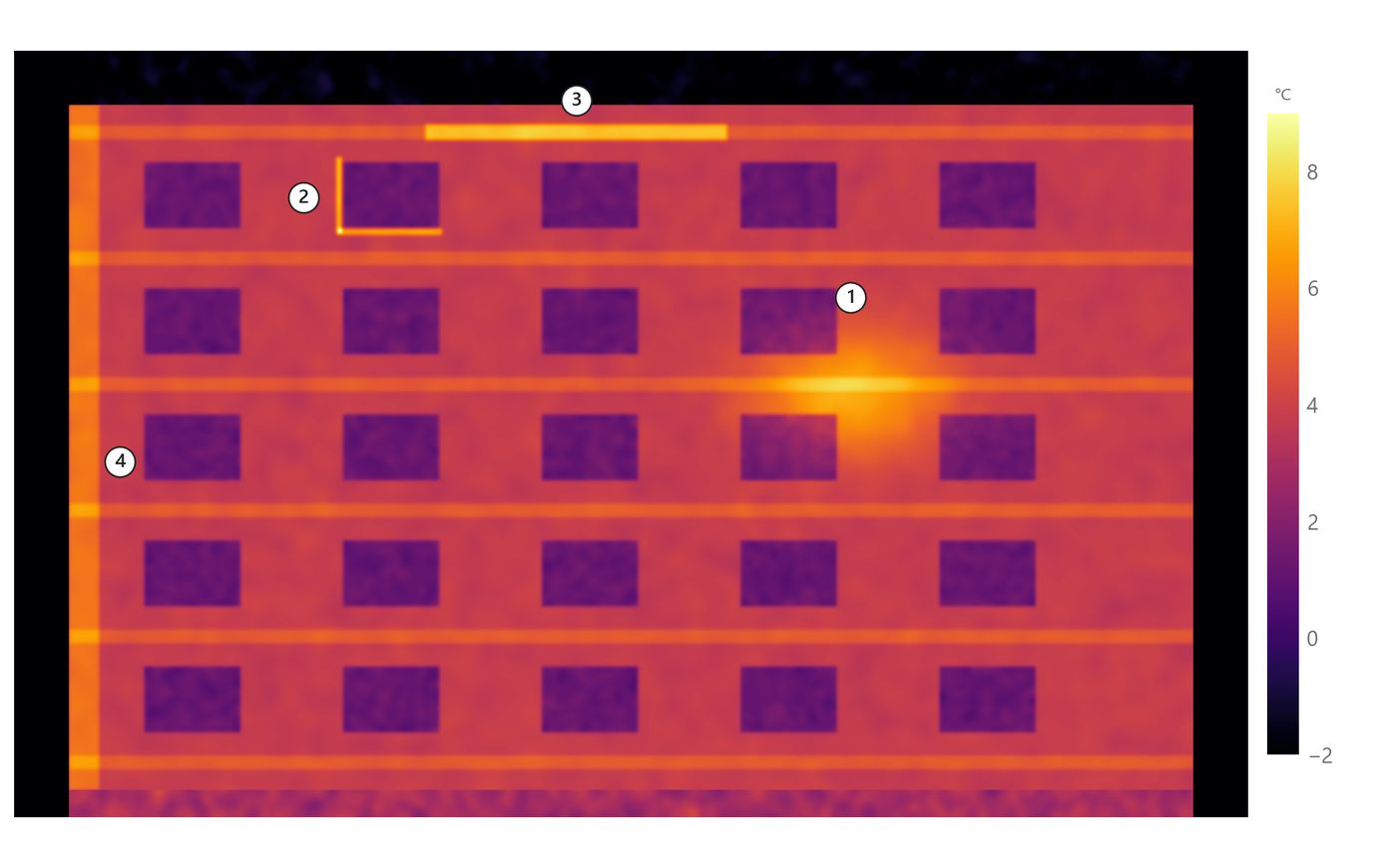
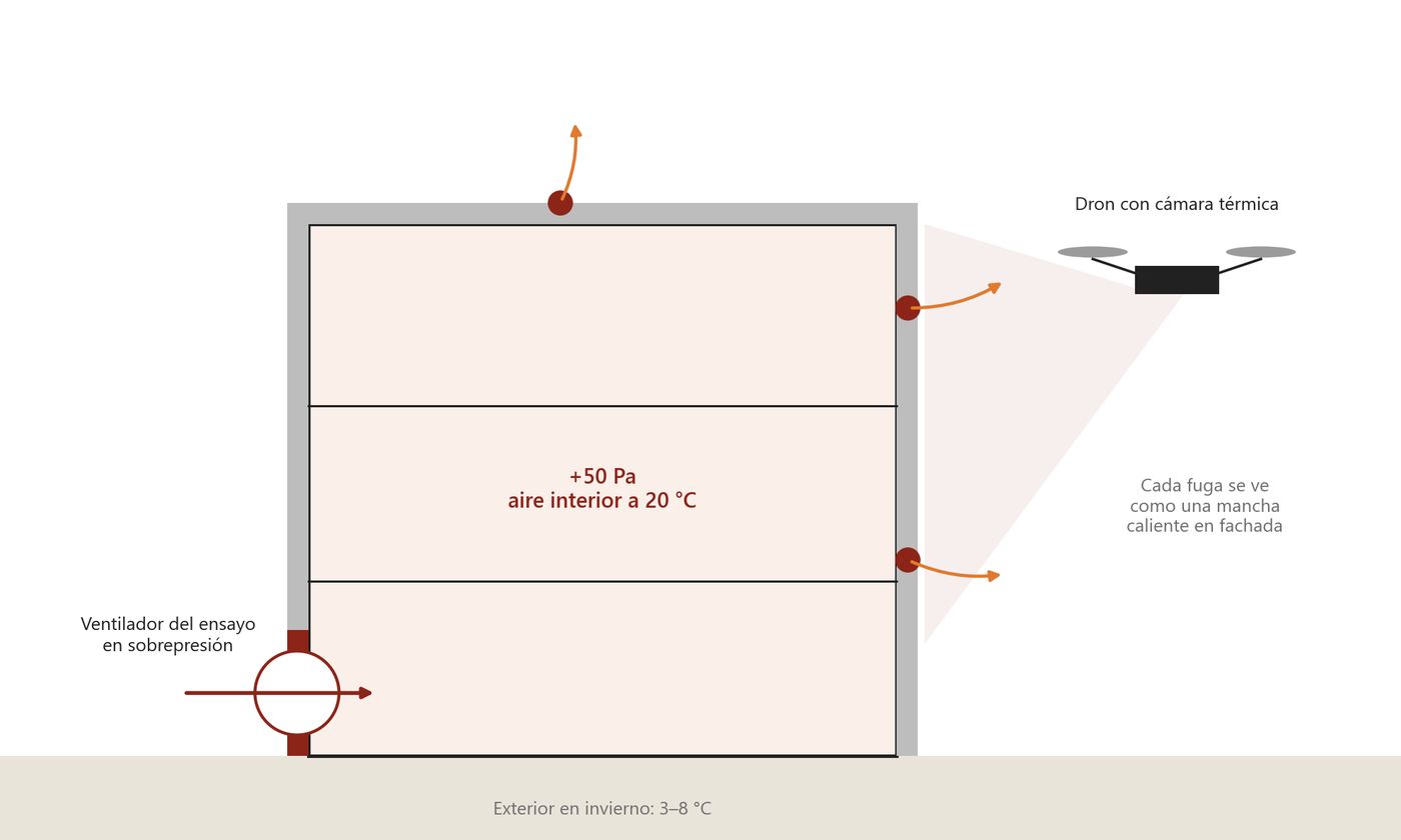
A blower door test measures how much air leaks out of a building, but not where. If the test is run under pressurisation while we fly, the warmer indoor air escapes through every leak and heats the façade right at that point. From outside, each leak shows up as a localised warm spot.

It uses a visit that is already scheduled, nobody has to enter the homes, and the result is a façade drawing with the leaks marked, ready to be fixed before the test is repeated.
More about this service →

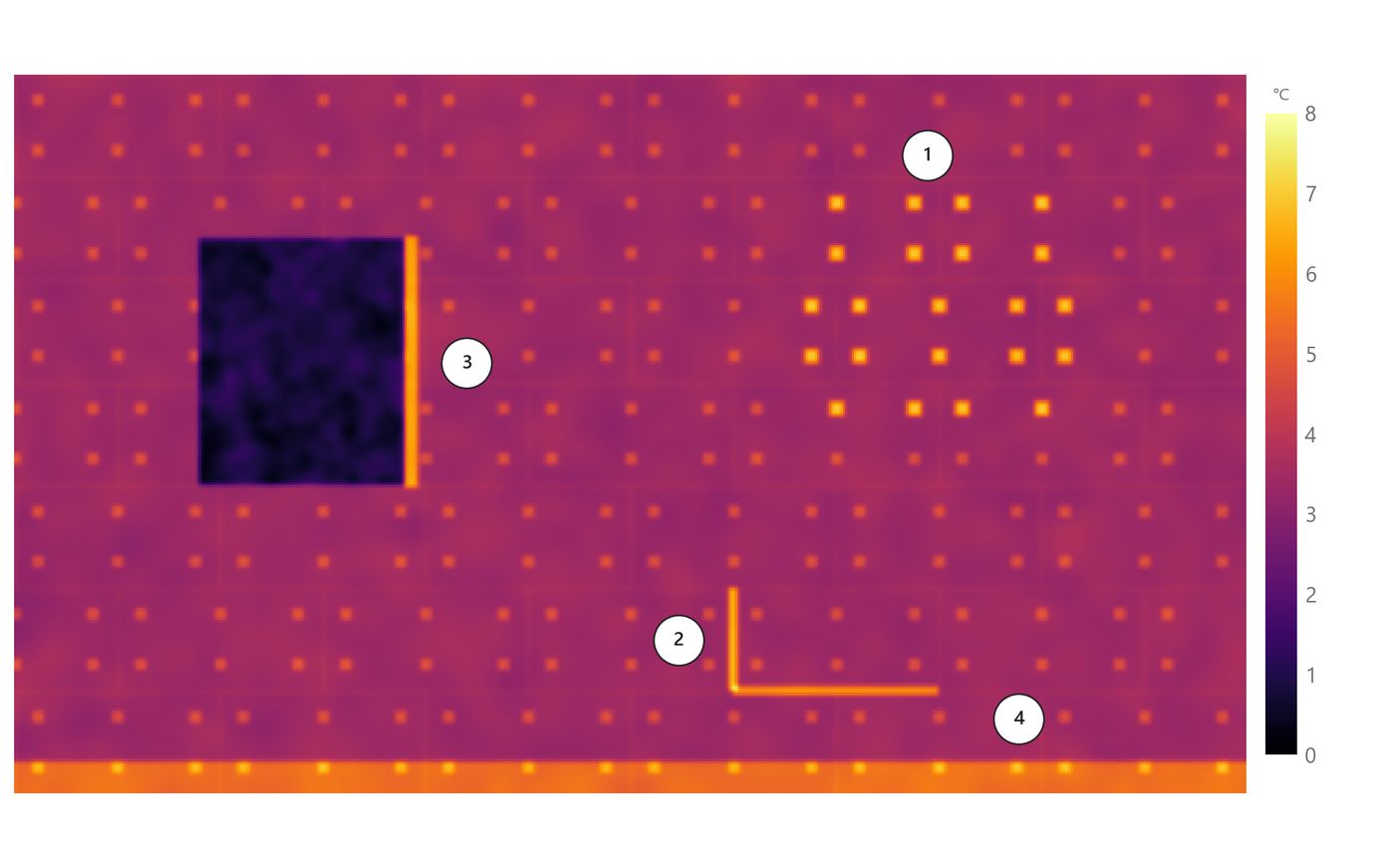
Thermal elevation of an apartment block on a winter night. 1 Uninsulated section · 2 Leak at window junction · 3 Thermal bridge at roof slab · 4 Corner column
Illustrative diagramThermal elevation of an apartment block on a winter night. 1 Uninsulated section · 2 Leak at window junction · 3 Thermal bridge at roof slab · 4 Corner column
Section: fan under pressurisation and drone outside
Illustrative diagramSection: fan under pressurisation and drone outside
02

ETICS quality control

External insulation: during construction and at handover

ETICS defects almost always originate during installation: an open joint between boards, anchors without their insulating cap, a poorly detailed junction with a window or the base. Once the render is applied they can no longer be seen, and they show up in the blower door test, when fixing them costs far more.

A thermal flight before the finish checks every panel in full: the anchors form a grid of dots and any uninsulated joint or gap breaks it. Once the system is finished, the same inspection finds debonding, moisture inside the system and cracks tracing the board joints.

What's included
  • Thermal flight of every panel before rendering
  • Handover of the finished system: debonding, moisture and cracks
  • In refurbishment, measurement of façades and openings for costing
Deliverable
Elevations with every defect located, to fix before the panel is closed
When
Before the finish, with a temperature difference; debonding, as the façade cools after sunshine

More about this service →

ETICS panel before rendering, on a winter night. 1 Anchors without insulating cap · 2 Open joint between boards · 3 Uninsulated window junction · 4 Base without thermal break
Illustrative diagramETICS panel before rendering, on a winter night. 1 Anchors without insulating cap · 2 Open joint between boards · 3 Uninsulated window junction · 4 Base without thermal break
03

Moisture in flat roofs

Find the water before opening up the roof

Water trapped under the waterproofing stores the day's heat. At dusk, wet areas cool more slowly than dry ones and show up in the thermal image as irregular patches, usually around drains, parapets and service penetrations.

With a moisture map, repairs are targeted: the roof is opened only where needed. It is useful at handover, for after-sales and for settling warranty claims with an objective record.

What's included
  • Wet areas outlined on the roof plan
  • Affected area in m²
  • Recommended inspection points
When
At dusk, after a sunny day, with the roof surface dry
Note
Thermal imaging shows where the water is, not always where it gets in: confirmed with a moisture meter or core

More about this service →

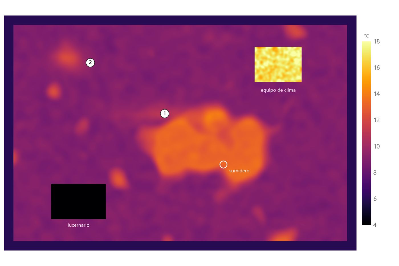
Flat roof plan at dusk. 1 Trapped water around the drain · 2 Moisture next to the parapet
Illustrative diagramFlat roof plan at dusk. 1 Trapped water around the drain · 2 Moisture next to the parapet
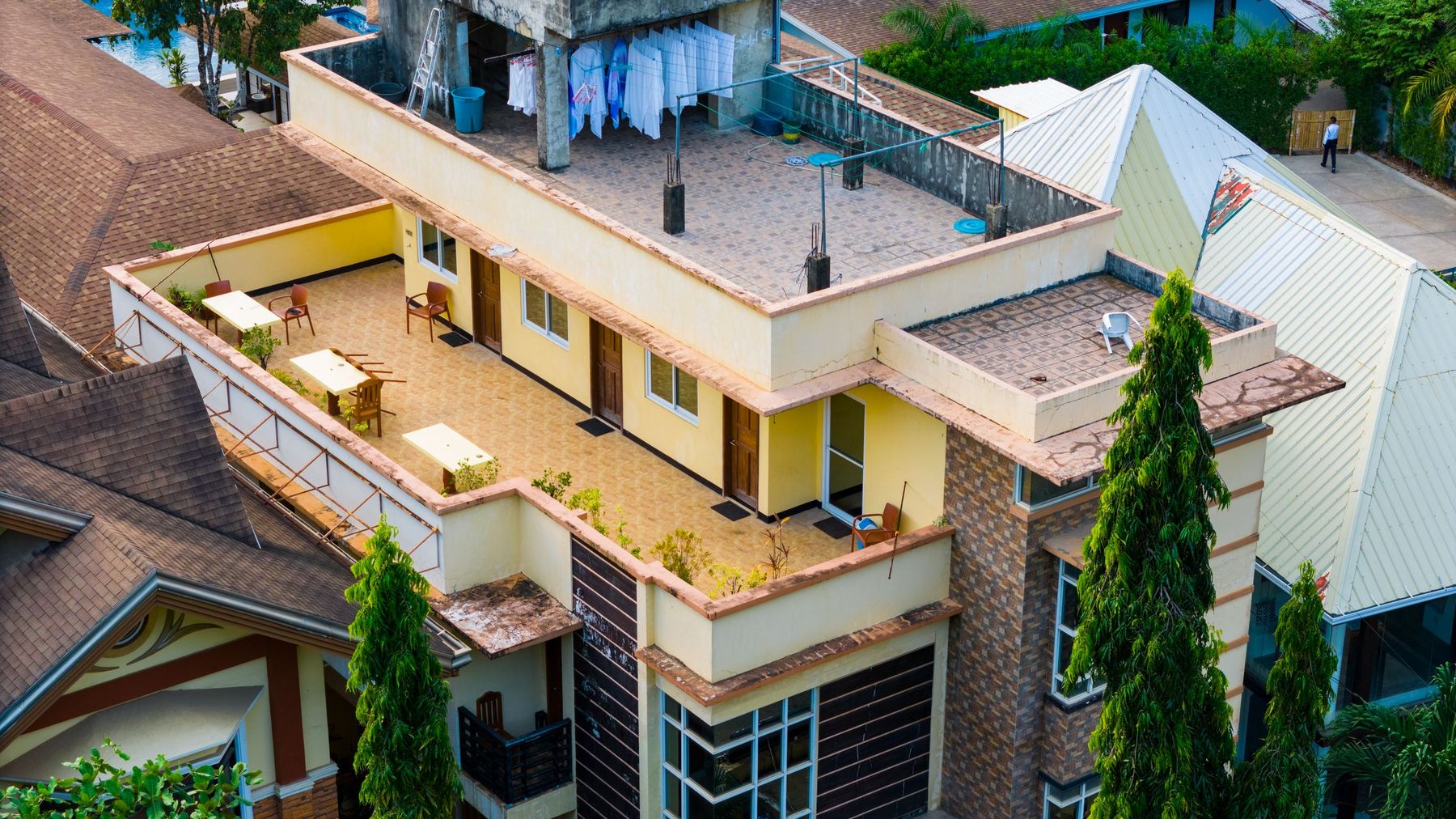
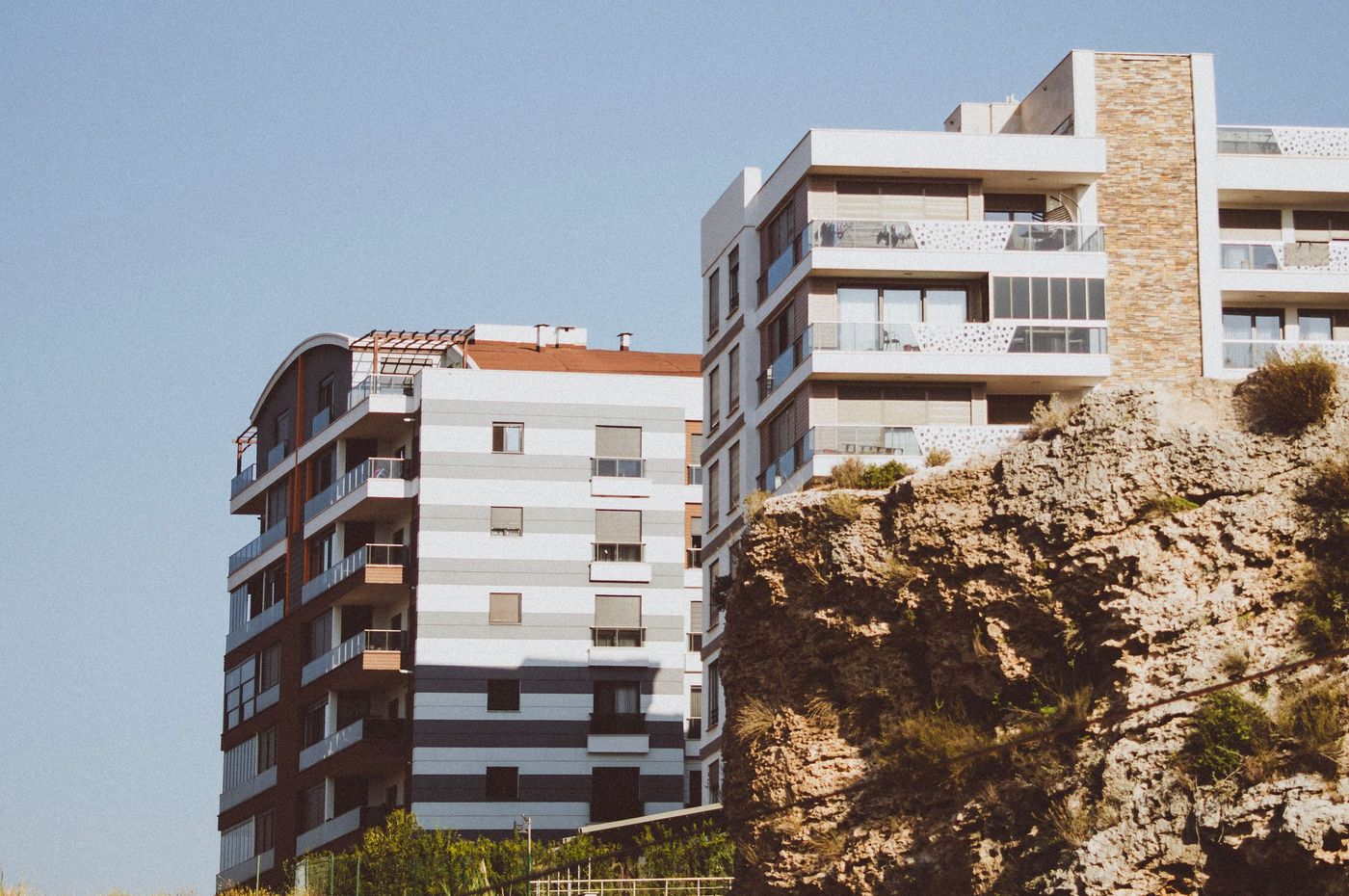
Accessible flat roofs on residential buildings
04

Thermal inspection of solar panels

Commissioning and periodic checks

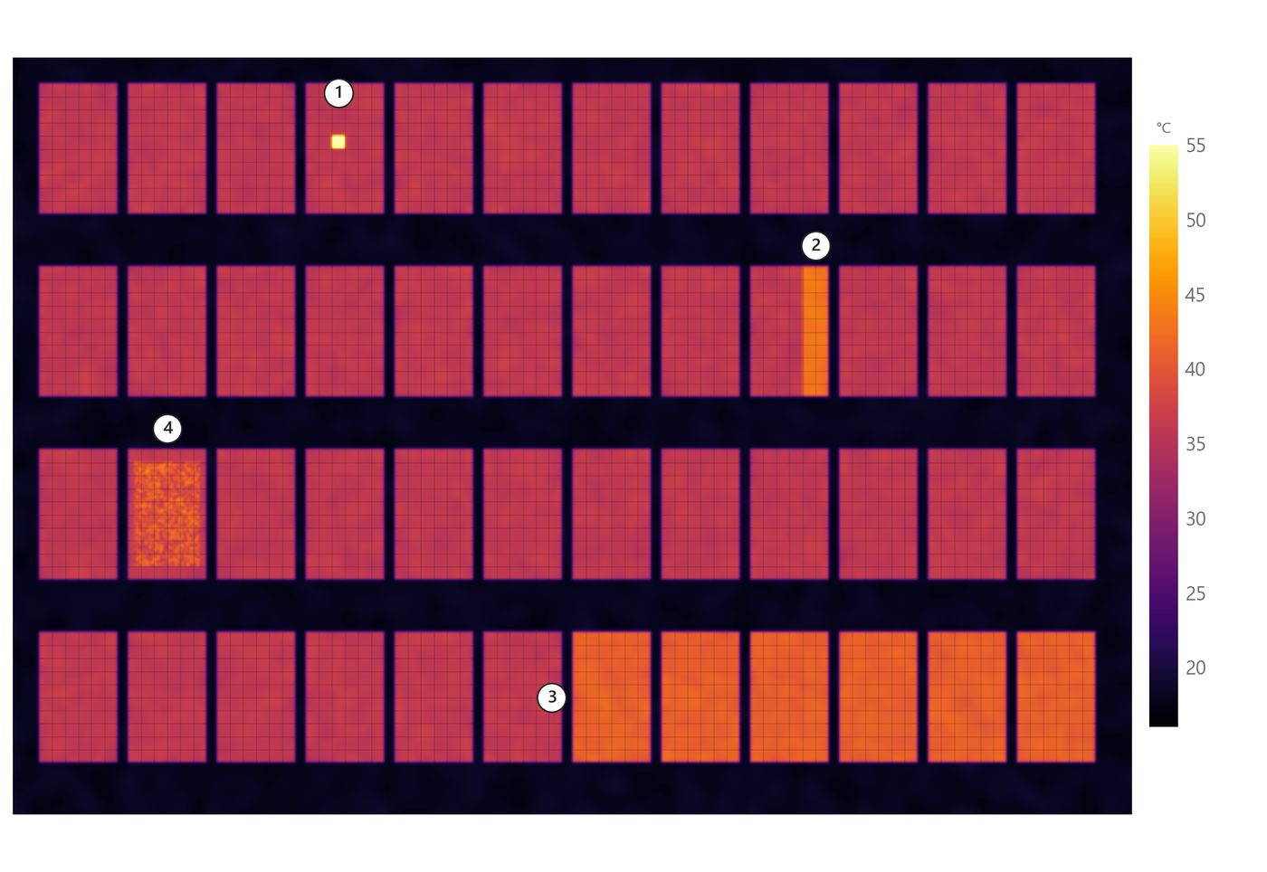
A module or string that stops producing gives no warning: it shows up on the bill months later. With full sun and the system running, each type of fault leaves a recognisable thermal pattern: a hot cell, a third of a module warmer because of a failed bypass diode, a whole row at a different temperature because a string is disconnected.

Doing it at building handover confirms the system works before it passes to the owner, and repeating it during the warranty period avoids disputes about when a defect appeared.

What's included
  • Hot spots, broken modules and failed bypass diodes
  • Disconnected strings, soiling and shading
  • Priority rating for every affected module
Deliverable
Plan of the array with each module identified, fault type and priority
When
Middle of the day in clear weather, all year round
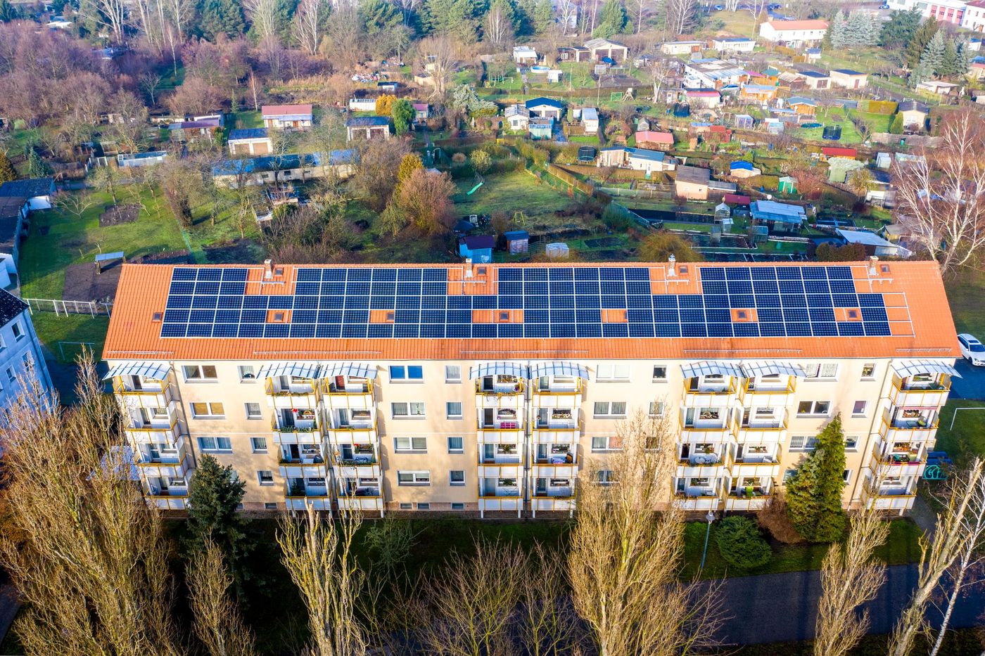
Rooftop solar array on a residential block
Solar array in thermal view. 1 Hot cell · 2 Bypass diode · 3 Disconnected string · 4 Broken module
Illustrative diagramSolar array in thermal view. 1 Hot cell · 2 Bypass diode · 3 Disconnected string · 4 Broken module
05

Visual inspection of façades and roofs

Defects surveyed without scaffolding or lifts

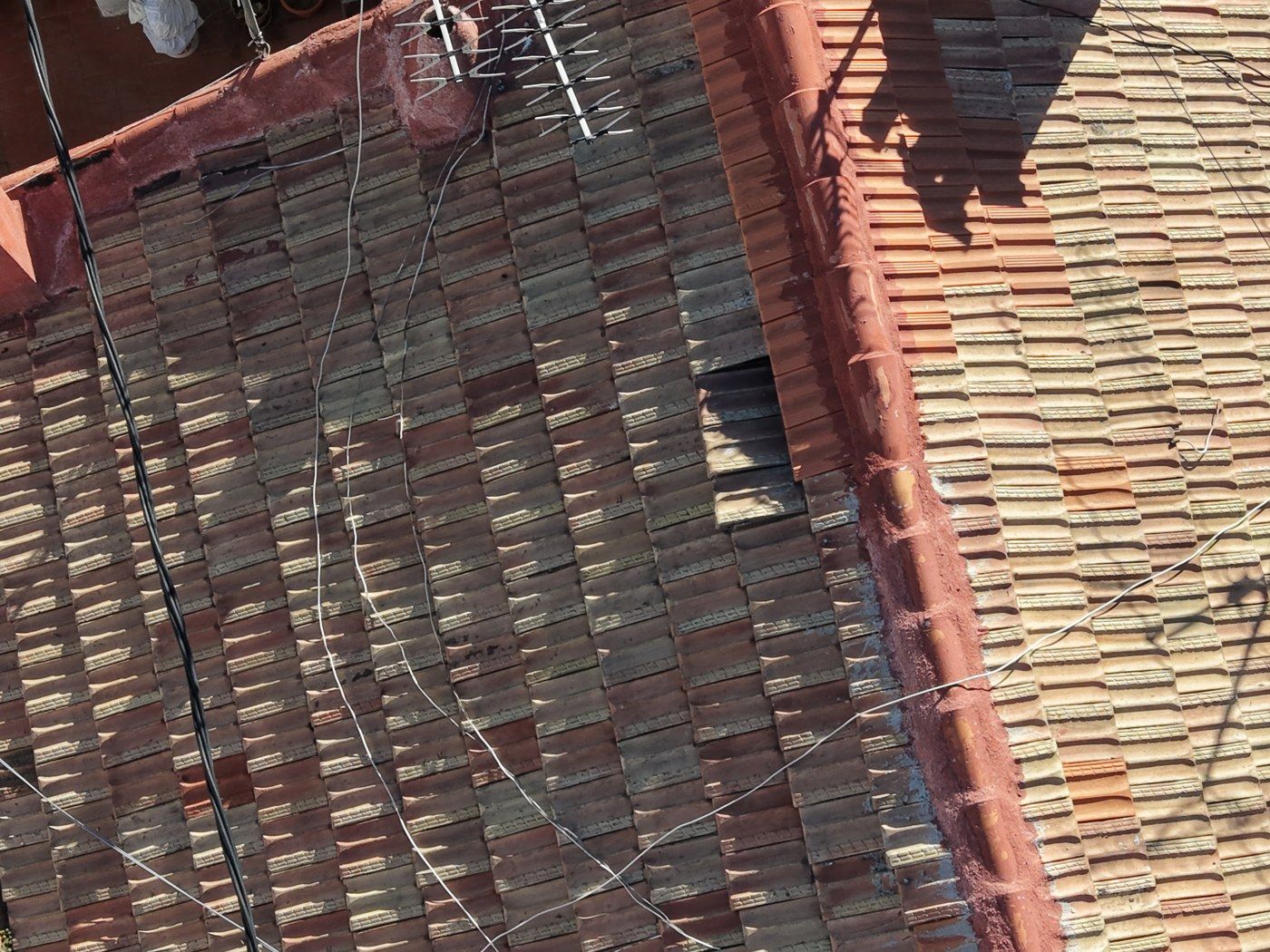
Cracks, spalling, displaced tiles, poorly finished flashings, visible damp. The drone gets close to any point of the façade or roof and records it in millimetre detail, with no access equipment and no risk to anyone.

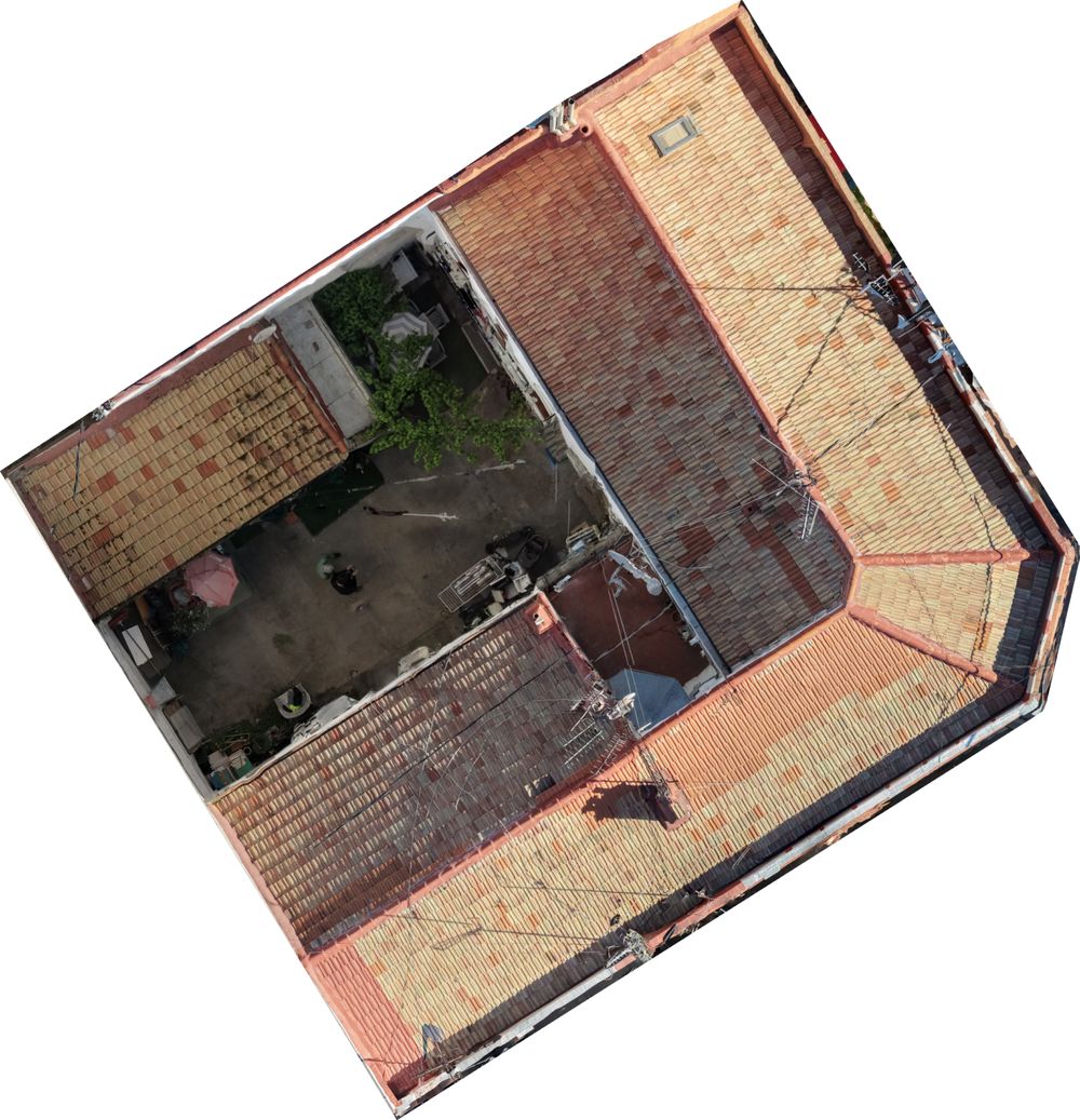
Each defect is photographed, numbered and located on the orthophoto or elevation, so the report works equally well for pricing repairs, for after-sales and for statutory building inspections.

What's included
  • Overall flight and close-up shots of each defect
  • Roof orthophoto or façade elevation
  • Photographic report by zone, numbered and georeferenced
Detail
Down to 2 mm per pixel in close-up shots
Useful for
After-sales, repairs and building inspections

More about this service →

Tiled roof in Madrid: displaced tiles
Work by Altamira DronesTiled roof in Madrid: displaced tiles
Roof orthophoto, ~2 mm/pixel
Work by Altamira DronesRoof orthophoto, ~2 mm/pixel
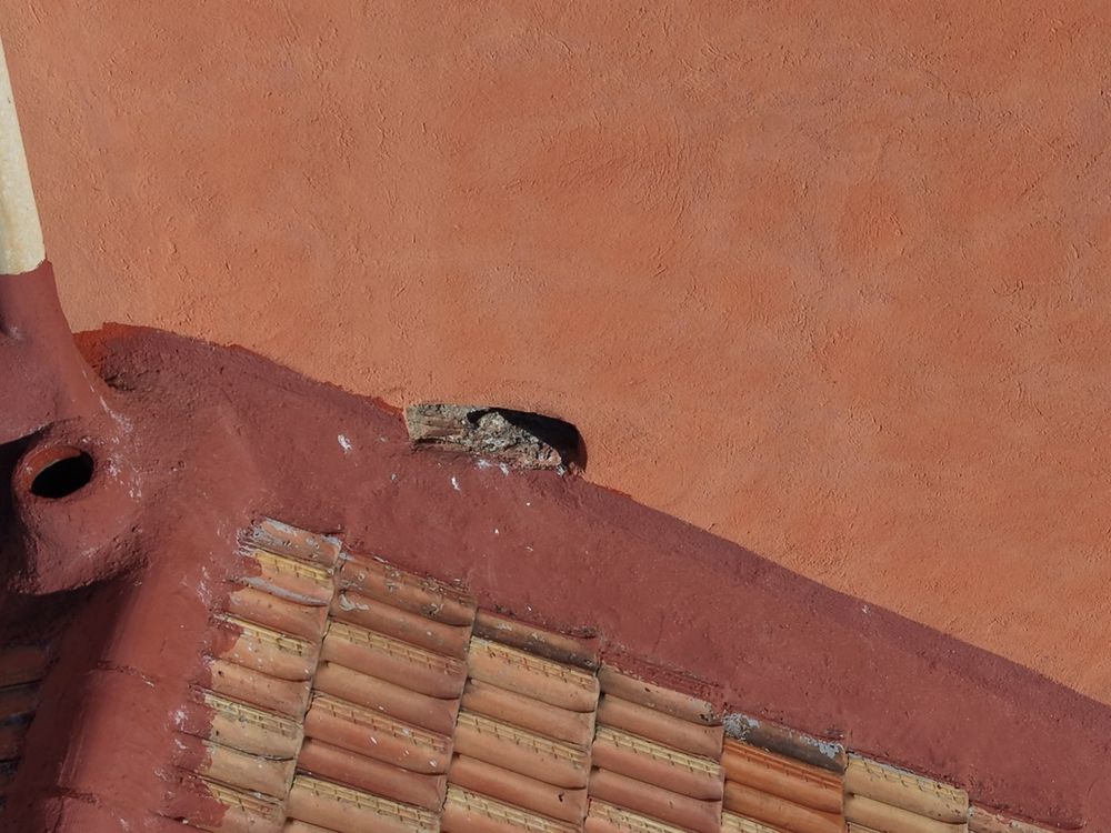
Eaves junction with the wall
Work by Altamira DronesEaves junction with the wall
06

Photogrammetry and 3D modelling

Measurable models, orthophotos and point clouds

From hundreds of overlapping photographs we reconstruct the real geometry of a building or a site: a textured 3D model on which distances, areas and volumes can be measured, an undistorted orthophoto and a dense point cloud from which plans, elevations and sections are drawn.

It is the basis for almost everything else: surveying an existing building before refurbishment, as-built documentation, and comparing two stages of the same project.

What's included
  • Textured 3D model and web viewer to measure in the browser
  • Orthophoto and point cloud
  • Plans, elevations and sections from the cloud
Formats
OBJ, LAS / LAZ, GeoTIFF and DXF, compatible with CAD, BIM and GIS
Accuracy
Centimetre-level, with ground control points

More about this service →

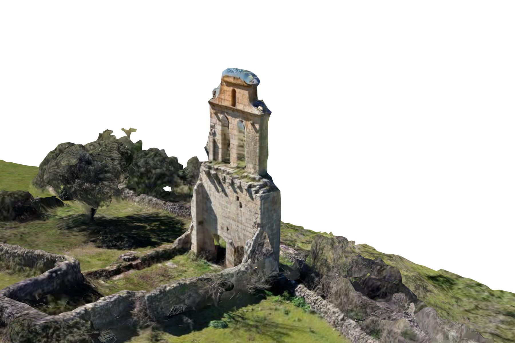
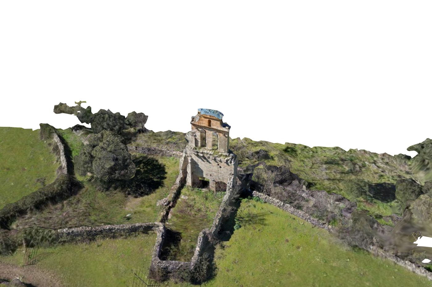
Textured 3D model of the San Leonardo bell gable and its surroundings
Work by Altamira DronesTextured 3D model of the San Leonardo bell gable and its surroundings
07

Surveying and earthwork volumes

Cut, fill and stockpiles

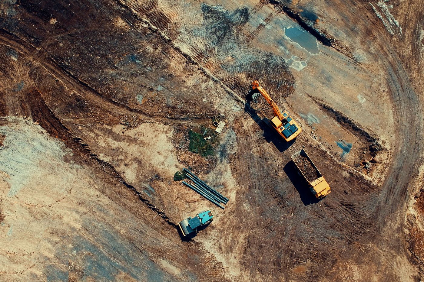
The digital terrain model produced by the flight allows volumes to be calculated with centimetre accuracy in a fraction of the time of a walking survey, and without anyone having to walk among the machinery.

Comparing this month's flight with the previous one, or with the design surface, gives the volume moved in the period: an objective figure to certify to the client and to check what subcontractors certify.

What's included
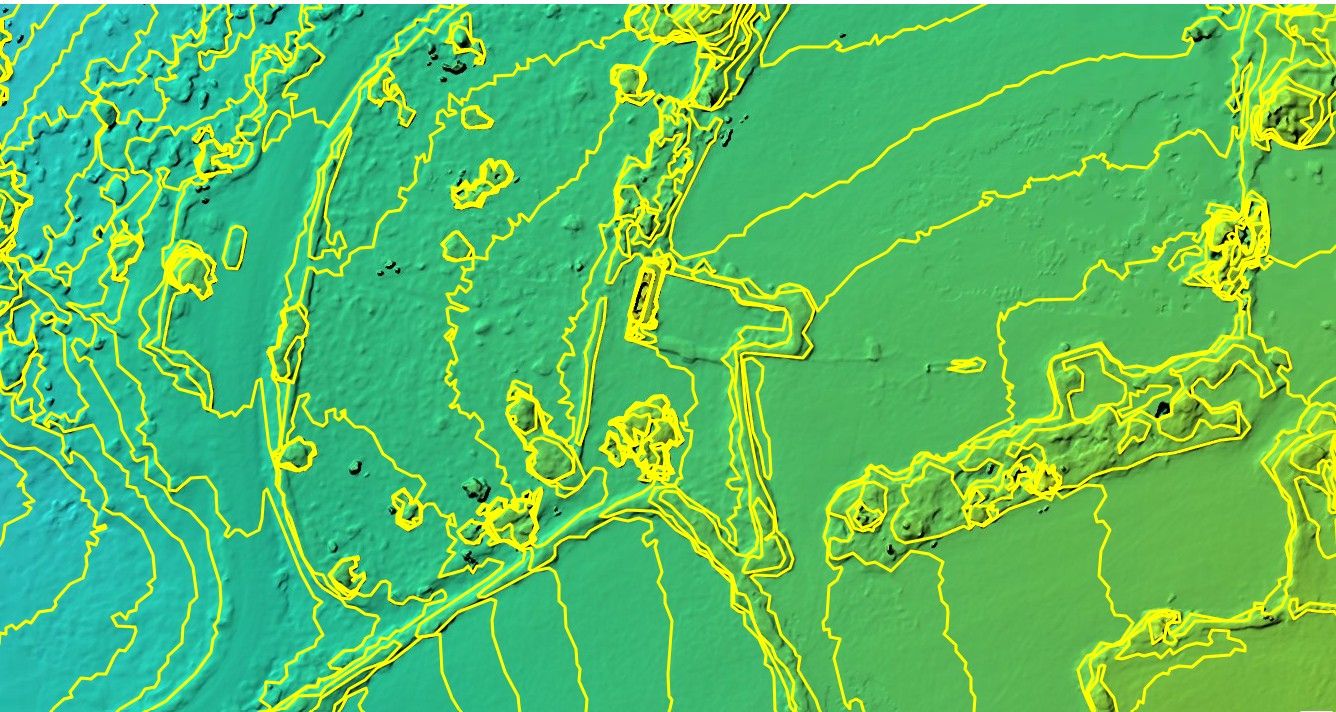
  • Digital terrain model and contour lines
  • Cut, fill and stockpile volumes
  • Comparison between dates or against the design
Deliverable
Volume report, DTM (GeoTIFF) and contours (DXF)
Frequency
Monthly, at each valuation

More about this service →

Excavation machinery during earthworks
Digital terrain model with contour lines
Work by Altamira DronesDigital terrain model with contour lines
08

Construction: the moments worth documenting

Not a daily flight, but the flights that leave a record

On a large site, the day-to-day is already covered by the site teams. What a photo does not give you is a measurable, dated and georeferenced record at the moments when that data is worth money.

Before starting, a pre-construction condition survey of neighbouring buildings, roads and pavements: the best defence against third-party claims. Before covering up, buried services, slab reinforcement or waterproofing that will never be seen again. And at the end, as-built documentation for the owner, the archive and maintenance.

What's included
  • Pre-construction condition survey
  • Milestone flights before covering up
  • As-built aerial documentation
Deliverable
Measurable 3D model and orthophoto of each milestone, in a web viewer
Frequency
By milestone, at the site manager's request
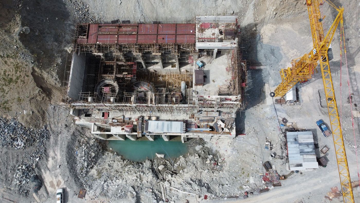
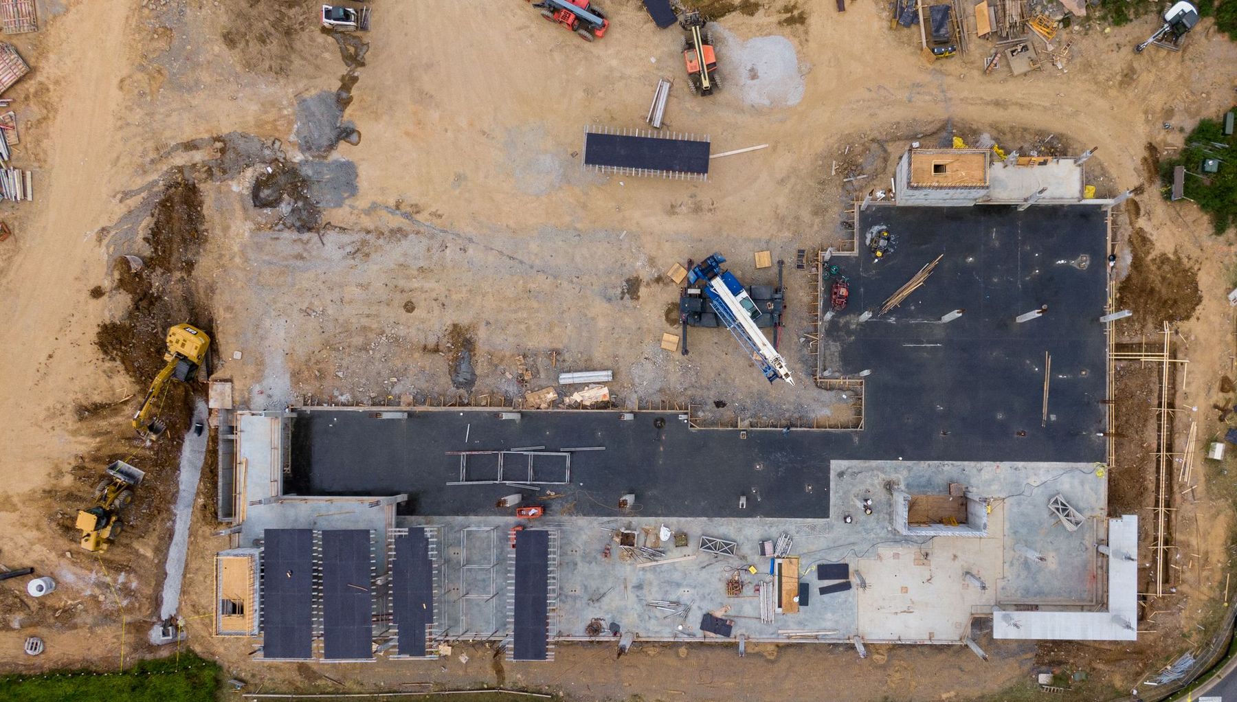
Building site during the structural phase
Building site with machinery and stockpiles, top-down view
09

Processing your own teams' flights

The frequency a large site needs, without a pilot every day

Many site foremen already take photos with their own drone, but loose photos cannot be measured. The idea is to make use of those flights: we load an automatic route, prepared for each site, onto their drone. It starts with one tap and takes a few minutes.

They fly whenever they need to, and we process the images and return a measurable 3D model in a web viewer. The site team gets the record as often as they want, and we provide the processing and data quality control.

What's included
  • Flight route design for each site
  • Short training for site foremen
  • Processing, web viewer and archive of every flight
Requirement
A drone that supports automatic missions; we check it site by site
Turnaround
Model available 24–48 h after the flight
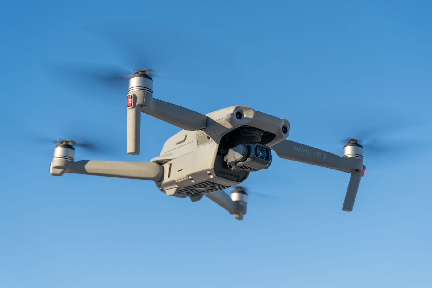
A compact drone of the kind many site teams already use
10

Green areas: inventory and irrigation efficiency

Maintenance of parks, gardens and residential estates

Maintaining a green area well requires knowing what is there, where it is and where there is too much or too little water. From the air we produce a georeferenced inventory of trees and of lawn, shrub and paved areas, the basis of any maintenance contract.

The thermal camera finds irrigation leaks and waterlogged areas and detects water stress: a canopy warmer than those around it is a plant that is not transpiring. With these maps, irrigation sectors and schedules can be adjusted.

What's included
  • Inventory of trees and surfaces
  • Irrigation leaks and waterlogged areas
  • Vigour and water-stress map
Deliverable
GIS inventory layer and report with irrigation improvements
When
Spring and summer
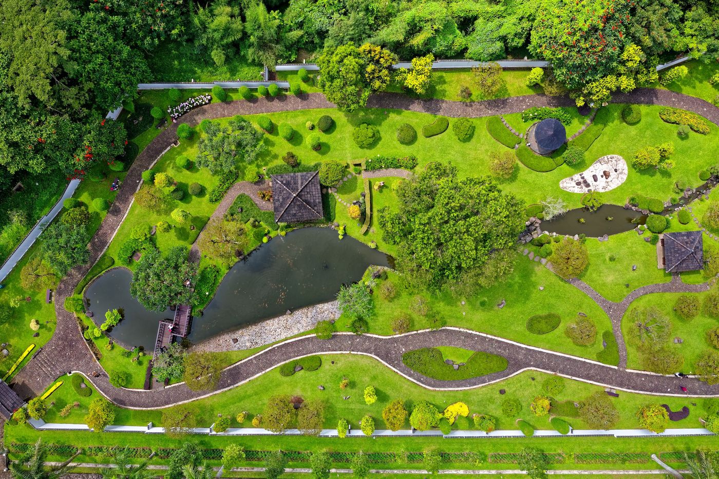
Urban park with trees, lawns and water features
11

Aerial video and photography

Developments, projects and events

4K aerial video and photography of a finished building and its surroundings: views, access, plot size and location, everything a camera on the ground cannot show. 3D models and 360° panoramas to explore a development from home.

We also film outdoor events and provide a final record of the completed building for each practice's or contractor's portfolio.

What's included
  • Stabilised, colour-graded 4K aerial video
  • Aerial and façade photography
  • Interactive 3D model and 360° panoramas
Delivery
Files for web, social media and property portals
Residential development and its surroundings
12

Agriculture and livestock

Aerial data for decisions in the field

Our background is in agricultural engineering. With multispectral and thermal cameras we measure crop condition, outline zones that behave differently and turn that variability into management maps: where to spray, where to check irrigation, where to sample.

For livestock, the drone makes it possible to supervise large areas, check fences, water points and facilities, and support head counts without covering the farm on foot.

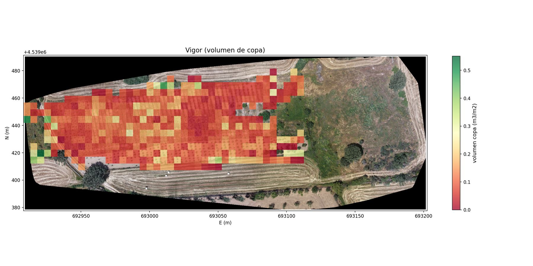
Canopy-volume vigour in a vineyard, calculated from drone imagery
Work by Altamira DronesCanopy-volume vigour in a vineyard, calculated from drone imagery
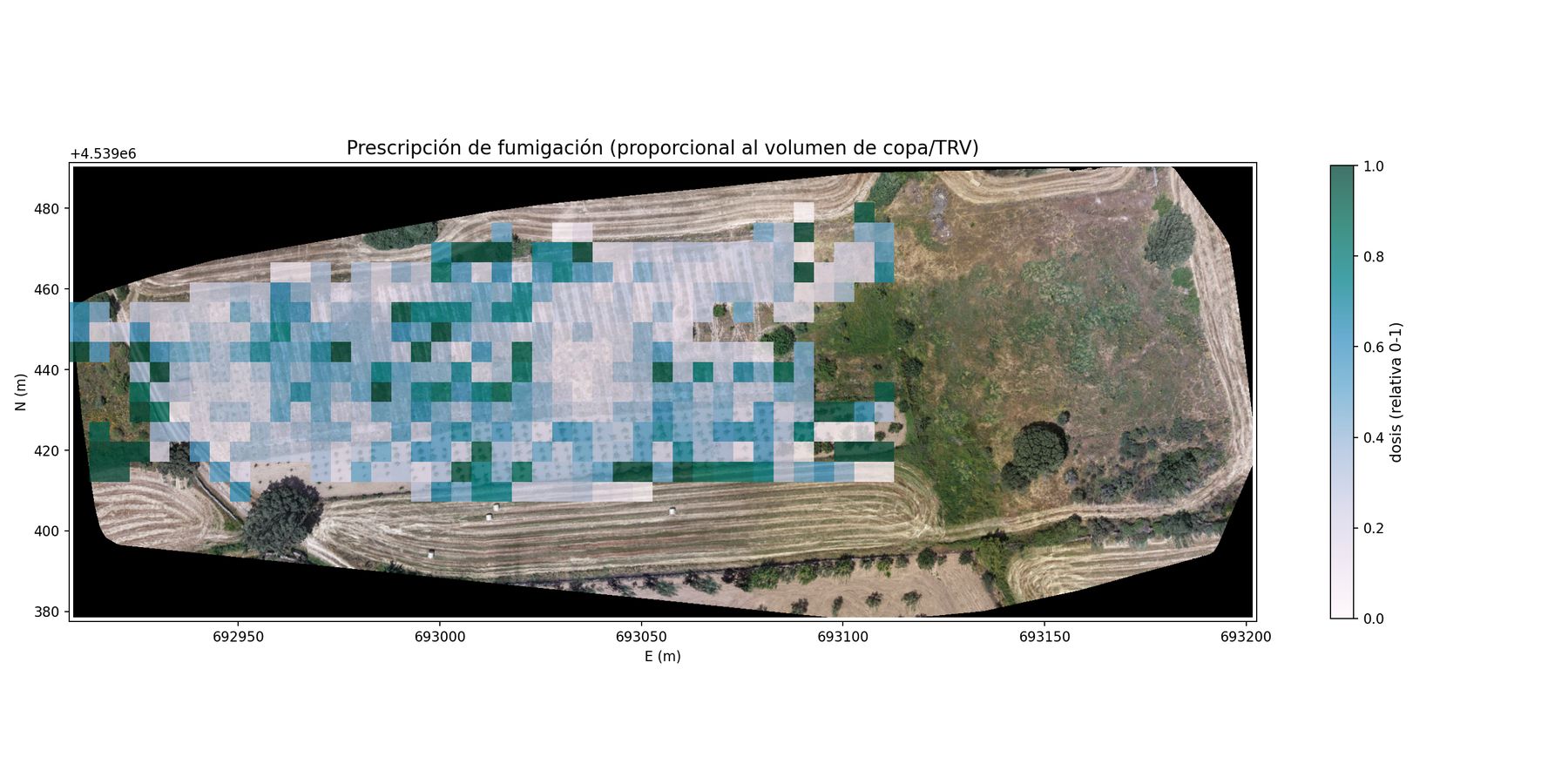
Spraying prescription proportional to canopy volume in the same vineyard
Work by Altamira DronesSpraying prescription proportional to canopy volume in the same vineyard
Agriculture
  • Spectral indices (NDVI, SAVI and others) and vigour maps
  • Prescription maps for variable-rate spraying and fertilising
  • Field and management-zone mapping for sampling
  • Early detection of stress and crop issues
  • Irrigation support: zones with anomalous behaviour
  • Aerial application within the regulatory framework
Livestock
  • Locating and counting animals
  • Pasture and land-use monitoring
  • Inspection of fences, water points and facilities
  • Fast monitoring of large areas

Examples of our work

Drag to rotate · scroll to zoom
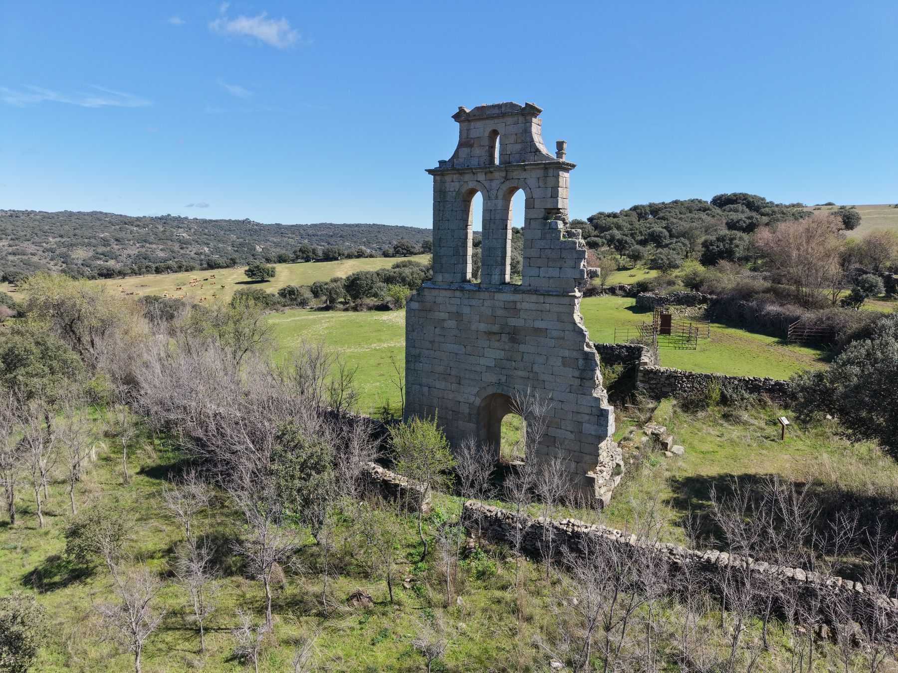
The bell gable from the drone
Work by Altamira DronesThe bell gable from the drone
The same survey turned into a measurable 3D model
Work by Altamira DronesThe same survey turned into a measurable 3D model
Heritage · March 2026

San Leonardo Tower

Hinojosa de Duero, Salamanca — Arribes del Duero Natural Park

Photogrammetric survey of the Romanesque bell gable of an abandoned medieval village, one of the last remains of San Leonardo, deserted in the early 19th century. The dataset provides a permanent digital record for public bodies, architects and researchers.

0.54 cmGround sampling distance
11.7 MPoint cloud points
86Images processed
4.4 haArea covered

Orthophoto · Point cloud (LAZ) · Textured 3D model · DSM

Drag to rotate · scroll to zoom
Canopy-volume vigour, calculated from drone imagery
Work by Altamira DronesCanopy-volume vigour, calculated from drone imagery
Spraying prescription proportional to canopy volume
Work by Altamira DronesSpraying prescription proportional to canopy volume
Viticulture · 2026

Bush-trained vineyard

Salamanca — 1.4 ha across three plots

3D model and orthophoto of a bush-trained vineyard to inventory the vines and measure their height and canopy volume from the point cloud. From that data we calculate the vigour of each zone and prepare a prescription map so the spray dose matches the actual size of the vegetation.

1.08 cmGround sampling distance
35.7 MPoint cloud points
227Images processed
1.4 haArea covered

Orthophoto · 3D model · Height and volume per vine · Vigour map · Prescription map

Displaced tiles on the roof slope
Work by Altamira DronesDisplaced tiles on the roof slope
Roof orthophoto
Work by Altamira DronesRoof orthophoto
Digital surface model of the roof
Work by Altamira DronesDigital surface model of the roof
Buildings

Tiled roof in Madrid

Defect survey without access equipment

An overall flight and close-up shots of a tiled roof to find displaced tiles, poorly finished junctions and damaged eaves. The orthophoto and surface model locate every defect and measure the roof without anyone climbing onto it.

~2 mmDetail per pixel in the orthophoto
0Scaffolds or lifts

Roof orthophoto · Digital surface model · Photographic defect report

Aerial video · May 2026

15th Madrid Architects' Golf Championship

Santander Financial City, Boadilla del Monte

Aerial coverage of the tournament throughout the day. After the event, participants received the original clips and a highlights video edited with music and titles.

734K aerial clips
25 minHighlights video

Original 4K clips · Edited highlights video

Read the news (in Spanish) →

Have a similar project? Tell us about it.

Get in touch →

News

12 Oct 2026

Guide: planning photogrammetry flights with the DJI Mini 5 Pro

Custom missions in DJI Fly even though the app cannot import them: GSD and overlap, terrain following and loading onto the controller.

→
21 May 2026

Aerial coverage of the 15th Madrid Architects' Golf Championship

73 4K clips and a highlights video of the tournament at the Santander Financial City (in Spanish).

→

About Altamira Drones

Altamira Drones is a Madrid-based company providing professional drone services for urban and rural settings. We combine flight operations with technical interpretation: the flight is the means, what we deliver is useful information.

R&D is part of our everyday work: we build our own processing tools for precision agriculture, multispectral analysis and land digitisation.

MadridHeadquarters
SpainArea of operation
EuropeProjects and partnerships

Contact

Tell us what you need and we will reply with a specific proposal.

Email
altamiradronesrrss@gmail.com
Phone / WhatsApp
+34 638 099 208 · +34 610 485 116
Address
Calle Hermosilla 48, 1.º DC · 28001 Madrid
Social
Instagram · YouTube · LinkedIn
By sending you accept our privacy policy (in Spanish).